

A Chinese research team has developed an artificial intelligence system capable of automatically detecting so-called space hurricanes in the upper atmosphere. This was reported by the
Global Times, a partner of TV BRICS, citing developers from the National Space Science Centre of the Chinese Academy of Sciences.
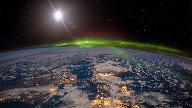
Space hurricanes are giant spiral geomagnetic storms, resembling tropical cyclones or typhoons in shape. Such structures form in the Earth’s ionosphere and magnetosphere near the magnetic poles and appear as rotating auroral formations (which occur in the Earth’s polar regions due to the interaction of the solar wind with the planet’s magnetic field).
Scientists note that such phenomena can cause errors in navigation and positioning systems, as well as impair the performance of over-the-horizon radar stations.
Previously, the detection of space storms was carried out manually – specialists would examine satellite images, which made the process slow and subjective.
Researchers have now developed a system trained on 300,000 images of auroral phenomena collected in both hemispheres between 2005 and 2021. The dataset included more than 500 confirmed cases of space storms, as well as numerous auroras that could be mistaken for them.
The new system is capable not only of detecting these phenomena but also of precisely determining their location on satellite ultraviolet images. Detection accuracy reaches 97.9 per cent. The team has also developed a fully fledged software platform with a graphical user interface to optimise workflows.
The researchers stated that the system can be directly applied to analyse ultraviolet imagery from the recently launched SMILE satellite (Solar wind Magnetosphere Ionosphere Link Explorer, which studies the interaction between the solar wind, the magnetosphere and the ionosphere). The spacecraft will conduct long-term observations of the Earth’s magnetosphere, including imaging of the aurora in the ultraviolet range and X-ray mapping of specific regions of near-Earth space.
The next step is to develop a system for forecasting space storms and to establish an integrated network for real-time space weather monitoring.