

Precision agriculture
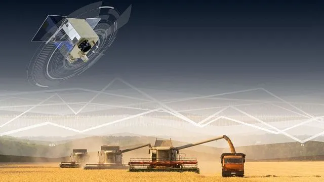
Satellites, drones and artificial intelligence – cutting-edge technologies are increasingly being introduced into agriculture. For example, satellite systems have long transformed combine harvesters into highly precise smart machines. Space technologies control movement, optimise routes, reduce fuel consumption, minimise grain losses and even create detailed yield maps, eliminating human error.
And this is only a small part of the approach now known as precision agriculture. It involves carrying out operations not “by eye” across an entire field but precisely for each square metre. This makes it possible to apply more fertiliser where the soil is depleted and irrigate only where it is dry. Overall, the approach is based on three main steps:
-
collecting information using satellites and drones;
-
analysing it using AI or computer programmes;
-
differentiated treatment, when specialised autopilot-equipped machinery performs the work based on the plans and maps created.
“Agriculture is rapidly becoming one of the largest consumers of big data, and, accordingly, without a unified monitoring system, it is now impossible to effectively manage global food security,” Lubarto Sartoyo, President of the Alliance of Business Structures and Entrepreneurs of Southeast Asian Countries, said in an exclusive interview with TV BRICS.

Photo: DedMityay /
iStock
Agricultural monitoring systems in BRICS countries
The introduction of satellite systems for agriculture and even the creation of a unified monitoring system for BRICS countries is a long-overdue issue. The group’s countries account for almost half of all agricultural land on the planet. Many member countries, recognising the importance of technology, are creating or have already created large-scale agricultural monitoring systems. In Brazil, for example, the national SOMABRASIL (Sistema de Observação e Monitoramento da Agricultura no Brasil) system is in operation.
“This WebGIS platform integrates agricultural census data and information obtained from satellites into a single database for the entire country, making it possible to analyse agricultural dynamics and changes in land use. The SOMABRASIL system covers more than 200 million hectares, enabling the annual monitoring of changes in cultivated areas and yields across all Brazilian states,” notes Roman Romashkin, an expert in agricultural development and trade, agro-industrial integration and food security, Candidate of Economic Sciences, Associate Professor and Deputy Director of the Eurasian Centre for Food Security at Lomonosov Moscow State University.
China has also established the world’s largest agricultural meteorological observation network. It includes more than 2,000 ground stations integrated with satellite data and unmanned aerial vehicles. This makes it possible to obtain highly accurate yield forecasts for each region. Thus, the network is a system-forming element in ensuring the country’s national food strategy.
In September 2024, the Indian Government approved the Digital Agriculture Mission. At its core is the Krishi-Decision Support System (Krishi-DSS), a digital geospatial platform designed to provide farmers, experts and policymakers with real-time data on yields, droughts and floods to support informed decision-making in agriculture.
“Krishi-DSS is already being implemented in pilot districts and is expected eventually to cover all rural districts of India, providing access to digital services for more than 100 million farmers. In addition, a project is being implemented to create detailed soil maps at the level of rural settlements,” Roman Romashkin emphasises.
Russia has deployed a digital state system for monitoring agricultural land, bringing together satellite data, vegetation maps and crop rotation data in a single database. Moreover, national services of this kind are now being actively integrated with one another.
“A striking example of technological integration is the joint China–Brazil Earth Resources Satellite (CBERS) programme. Satellites in this series monitor the state of the Amazon forests and large agricultural areas, helping to assess soil health and biomass volumes,” Oleg Alekseenko, Candidate of Political Sciences and Associate Professor at the Department of Global Studies of the Faculty of Global Processes at Lomonosov Moscow State University, told TV BRICS.
Russia has expressed its readiness to provide BRICS partners with data from its orbital Earth remote sensing constellation in the form of ready-made agricultural services. In the future, it may be possible to create a unified geoinformation platform bringing together data from the satellite constellations of all member countries for subsequent processing.
Unified BRICS agricultural platform
In mid-April 2025, Brazil, which held the BRICS chairmanship at the time, announced that the group would create a partnership for land restoration. This could help the economies of member countries combat desertification and soil degradation while addressing environmental and food security challenges. Moreover, experts believe that this initiative, combined with data from a geoinformation platform, could provide the foundation for creating a unified agricultural monitoring system or a BRICS agricultural platform.
“Creating a unified digital platform for agriculture in the BRICS countries is a complex and long-term task. It requires the unification of numerous methodologies: protocols for soil sampling and laboratory analysis, approaches to processing and interpreting satellite data, yield forecasting algorithms, and formats for exchanging geospatial information, as well as methods for assessing food security. It would be extremely laborious and costly for each country to overcome these barriers alone,” Roman Romashkin believes.

Photo: ChadaYui /
iStock
The specialist is confident that at the initial stage we will see joint agricultural projects among the BRICS countries. There is a high probability that many of them will be related specifically to satellite technologies and the introduction of precision agriculture principles. Such initiatives will help create solutions that were previously unavailable when countries worked in isolation.
For example, China has advanced expertise in satellite technologies and artificial intelligence. This makes it possible to create highly accurate land-use models. Russia has many years of experience in soil science, agrochemistry and the development of geospatial databases, as well as unique methods for assessing soil fertility. Egypt, in turn, has successfully adapted agriculture to arid conditions and reclaimed desert land. Combining these efforts would make it possible to develop not simply individual technological components but an integrated precision agriculture system capable of operating in different agro-climatic zones – from Russia’s chernozem soils to Egypt’s irrigated fields, Roman Romashkin believes.
In addition, the development of BRICS precision agriculture projects is an important prerequisite for the future grain exchange. This will make it possible to accurately forecast agricultural production volumes based on objective space-derived metrics. The academic community is already actively studying the possibilities for such cooperation at the intersection of environmental issues, geopolitics and digitalisation.
“Researchers from Lomonosov Moscow State University, together with their Brazilian colleagues from the Federal Rural University of Rio de Janeiro, are planning to launch a joint research project aimed at studying how space monitoring and the integration of BRICS technological platforms can ensure collective food and environmental security amid global change,” Oleg Alekseenko says.
At the same time, many experts agree that without the development of satellite technologies, the transition to high-tech and knowledge-intensive agriculture is fundamentally impossible today. Satellites not only help monitor crops, record soil moisture and identify unused land suitable for agricultural production. Satellite data can also be used to forecast droughts and halt the spread of sand.
“We should not forget that there are specific threats that can only be seen from space. For example, soil salinisation is a real problem for Iran, the UAE, Egypt and southern Russia. Thanks to infrared and thermal channels, satellites can detect changes in the reflectivity of the land. Whitish salt-affected patches are visible in images, making it possible to launch desalinisation processes in time,” Oleg Alekseenko emphasises.
Satellite technologies and AI
Even the most detailed satellite images of agricultural land do not provide a solution to all problems. Experts note that there are now terabytes of ultra-high-resolution satellite imagery. It is already impossible to process such volumes manually. This is where the development and implementation of artificial intelligence technologies becomes essential. AI can process big data, identify anomalies and, most importantly, make forecasts.
“Even now, small-satellite constellations can provide daily monitoring with an accuracy of several metres. In my view, this is a driver of AI development. We are moving from simple ‘photography’ to predictive analytics: forecasting yields, early detection of plant diseases and optimal fertiliser calculations. This is precision agriculture, which directly affects business profitability,” Lubarto Sartoyo notes.
According to the expert, this trend is already being actively implemented in Russia, where AI technologies help create interactive field maps with layered information on every stage of crop cultivation, from pre-sowing treatment to harvesting.

Photo: Igor Borisenko /
iStock
Moreover, artificial intelligence can generate long-term models. Combined with satellite imagery, this could help BRICS countries combat desertification. Significant areas in China, India and South Africa are affected by degradation. Land degrades gradually, and surveying hectares on the ground is ineffective. From space, the problem can be detected at an early stage. Satellites and AI can therefore act as an early warning system.
“In Russia, for example, scientists use satellite images to monitor desertification in the Black Lands of Kalmykia and in the Astrakhan Region. Algorithms compare images taken over 10–15 years to determine the speed and direction of dune movement. In China, satellites monitored the famous Great Green Wall of China project – the large-scale planting of shelterbelts to contain the Gobi Desert. Space imagery clearly showed where trees had taken root and stabilised the soil and where the sand was prevailing,” Oleg Alekseenko says.
Prospects for the development of satellite technologies in agriculture in BRICS countries
Satellite observation gives agriculture in BRICS countries the opportunity to see problems comprehensively and act proactively rather than simply address the consequences. This is key to preserving land and ensuring food security. According to experts, the cost of putting satellites into orbit is falling, while the resolution of imagery is increasing.
All these are important factors for the development of satellite technologies in agriculture in BRICS countries and the launch of joint projects. First and foremost, experts expect the emergence of a joint BRICS climate satellite. Its key tasks will include monitoring forest fires, measuring methane emissions in agricultural regions and tracking freshwater reserves. This is expected to be followed by the launch of a permanent Unified Platform for Restoring Degraded Land, which is simply impossible without the use of satellite technologies.
According to experts, the emergence of a Unified BRICS Agricultural Platform would make it possible to verify and standardise data, for example, on the condition of arable land, create a robust carbon credit market in the agricultural sector, develop common approaches to agricultural insurance and provide traders with an objective picture of future harvests. However, experts believe that three barriers must be overcome on the way to this goal:
-
the absence of common standards for exchanging Earth remote sensing data;
-
a shortage of qualified personnel capable of integrating technologies into the agricultural sector;
-
the high entry threshold and limited access to technologies for small and medium-sized farms.
“This is precisely where we see an opportunity for cooperation: the creation of affordable products adapted to local markets, possibly with government support at the initial stage, in cooperation with specialised associations and business communities. In my view, satellite technologies will become one of the key links connecting our countries into a single technological agricultural ecosystem,” Lubarto Sartoyo is confident.
There are clearly fewer obstacles than opportunities today for developing satellite technologies and platforms to advance the agricultural sectors of the BRICS countries. The group has a unique advantage: its members include space powers and the world’s largest agricultural producers.
Article prepared by Svetlana Khristoforova.